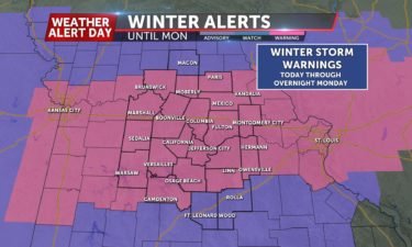
WEATHER ALERT DAY UPDATE: More Snow Today
The next round of snow arrives this morning and wraps up later tonight with an additional 1-3″ of snow possible.
Continue Reading The next round of snow arrives this morning and wraps up later tonight with an additional 1-3″ of snow possible.
Continue Reading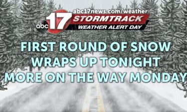
TONIGHT: Snow continues before midnight for areas along and north of I-70. Freezing drizzle is possible south, creating a glaze to 0.1″ of ice. Lows in the mid-20s. MONDAY: Another round of snow moves in from the west by morning and lasts for much of the day. An additional 1-3″ of snow will be possible.
Continue Reading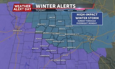
TONIGHT: Mostly cloudy and staying dry. Lows in the low 20’s. SUNDAY: Snow will begin to fly around 9am tomorrow and continue through the afternoon. Generally, 1-3″ of snow can be expected through the evening before snow tapers off to light freezing drizzle/sleet overnight. EXTENDED: Monday morning will likely be dry through 7-8am before snow picks
Continue Reading
TONIGHT: Mostly cloudy with a few showers. Lows near 35. SATURDAY: Temperatures falling through the day from the 30s through the 20s. Mostly cloudy with a few showers or light snow showers. No significant impacts expected. EXTENDED: A Weather Alert Day is in effect Sunday and Monday as our next winter storm takes shape and
Continue Reading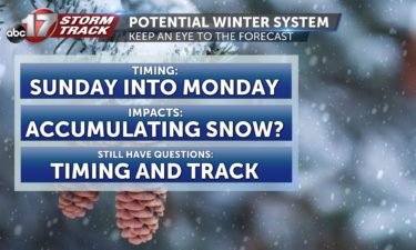
TONIGHT: Mostly cloudy with lows in the mid-30s. FRIDAY: Mostly cloudy and not as windy with highs in the upper 40s to low 50s. EXTENDED: A cold front moves through the area Friday night into Saturday, dropping the temperatures into the upper 30s for highs on Saturday with the potential for a few rain and
Continue Reading
TONIGHT: Partly to mostly clear. Lows in the low to mid-30s. THURSDAY: Partly sunny and windy. Gusts up to 30 mph. Highs in the upper 40s to low 50s. EXTENDED: Clouds increase Friday ahead of our next cold front that could bring a brief chance for showers and/or flurries into Saturday. No impact is expected.
Continue Reading
WEDNESDAY: We’ve fallen back into the upper teens and low 20’s to start out the day again, but we’ll do a better job at warming up. Highs will reach the middle to some upper 40s by this afternoon with some more sunshine. TONIGHT: Clouds will be increasing, which will help keep temperatures from getting quite
Continue Reading
TONIGHT: Mostly clear skies will continue with overnight lows in the lower 20’s. Winds will continue to weaken throughout the night. Wind chills will be in the mid-teens. WEDNESDAY: It will be a cold start to the day with temperatures in the low 20s, but with southwesterly winds, we can expect temperatures comfortable, in the
Continue Reading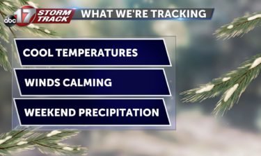
TUESDAY: After a bitterly cold start, we’ll only top out in the middle to upper 30’s. The sun will be out, but it won’t do much to warm us up. TONIGHT: Mostly clear skies will continue with overnight lows in the lower 20’s. Winds will continue to weaken throughout the night. EXTENDED: Temperatures will climb back to the
Continue Reading
TUESDAY: After a bitterly cold start, we’ll only top out in the middle to upper 30s. We will see some more sunshine so it will at least look nice. TONIGHT: Mostly clear skies overhead temperatures will dip back to near 20 for lows. Leading to another chilly start out the door tomorrow. EXTENDED: Temperatures will
Continue Reading
TONIGHT: Mostly clear skies and breezy conditions will continue this evening. Lows fall into the low 20s and upper teens. TUESDAY: Partly cloudy skies and cold temperatures can be expected out the door in the morning. Temperatures will feel like they’re in the 10s– have the heavy jackets ready. By the afternoon, we rebound into the
Continue Reading
MONDAY: We’re waking up to some mild temperatures with some light rain in the area. Those drizzle chances will stick with us toward this afternoon, but those mild temperatures will be leaving us. Winds will be picking up, moving in our latest shot of cold air. Temperatures will fall throughout the afternoon into the 30s,
Continue Reading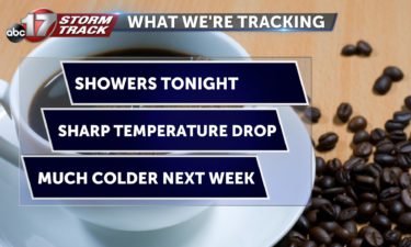
TONIGHT: Tonight our rain chances increase ahead of the cold front that will push through tomorrow. We’re expecting spotty showers across the viewing area through the night and into tomorrow. Lows will be staying warm in the mid to upper 40’s. TOMORROW: Spotty rain showers continue until the late morning/early afternoon. As the front passes through,
Continue Reading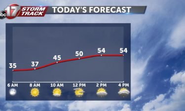
SUNDAY: We will start the day with a bit of sunshine but see increasing cloud cover into the afternoon hours. It will be a bit breezy with winds gusting up to 25 mph from the south but those will continue the warmer temperatures. High’s in the mid 50’s. SUNDAY EVENING: Rain chances start to beef
Continue Reading
TONIGHT: Clouds start moving into the area, and lows will be in the mid 30’s. TOMORROW: We will remain warm with temperatures stretching into the middle 50’s, however clouds will increase as we move throughout our Sunday. By the evening hours, rain will begin moving into the area. These showers will stay with us overnight and
Continue Reading
SATURDAY: There will be lots of sunshine today with clear skies and warmer temperatures. High around 50 degrees. SATURDAY NIGHT: A bit of cloud cover will roll into the viewing area but still leaving our skies mostly clear overnight. Lows in the upper 30’s. EXTENDED: Sunday will continue warming into the middle 50’s with mostly
Continue Reading
FRIDAY: We are in for a chance today as winds are starting to pick up this morning. Those gusts at times will reach up around 25 mph and will help carry in cooler air for this afternoon. Temperatures will struggle to get out of the upper 30s, topping out in the low 40s. TONIGHT: Winds
Continue Reading
TONIGHT: Mostly cloudy with a few showers south of I-70. Lows in the mid-upper 30s. FRIDAY: Clouds clear gradually, chilly and breezy with highs in the low 40s. EXTENDED: North winds will make Friday about 10-15 degrees cooler, but we’re dry heading into the weekend. Winds shift back southwest over the weekend, bringing temperatures back
Continue Reading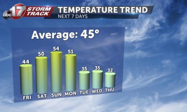
THIS AFTERNOON: Clouds will hang on across the area today. Temperatures will remain mild, in the mid to upper 50s. TONIGHT: Rain chances move in after sunset, and still look to mainly affect our southern counties. Activity still looks to be light in nature with the heaviest amounts around 0.10”. When the rain moves in you can
Continue Reading
THURSDAY: Sunshine will greet us heading into this morning, but clouds will be on the increase throughout the day. Temperatures will still be able to reach into the mid and some upper 50s. TONIGHT: Rain chances move in after sunset, and still look to mainly affect our southern counties. Activity still looks to be light
Continue Reading