
Weather

Tracking a dangerous warmup settling in
TODAY: Isolated showers and storms are possible through the early afternoon but most stay dry. The rain and accompanying clouds at least limit the heat today compared to the end of the weekend. The heat index this afternoon still reaches 100 degrees in some spots. TOMORROW: The first of a string of Weather Alert Days
Continue Reading
Tracking isolated storms before dangerous heat beginning Sunday
TONIGHT: Isolated showers and storms remain possible with most of Mid-Missouri staying completely dry. Overnight lows cool to the lower 70s with winds out of the south at 5-10 mph. TOMORROW: Isolated showers and storms remain possible with most of Mid-Missouri remaining dry once again. Areas that see storms can still expect plenty of dry
Continue Reading
Tracking less rain and more heat into the weekend
TODAY: Even hotter temperatures today will push down on storm chances and keep the majority of Mid-MO dry. Highs reach the upper 80s and heavy humidity pushes the heat index into the 90s. THIS EVENING: Conditions remain clear through sundown while more rain develops late overnight. Lows will remain warm in the 70s. EXTENDED: The
Continue Reading Tracking slim rain chances and a dangerous warmup
THIS MORNING: Isolated morning storms may bring lightning and downpours in spots. Most stay dry and mild warming quickly to the 80s before noon. TODAY: Mostly sunny and humid with highs in the upper 80s. The heat index reaches the mid-upper 90s. A few isolated storms remain possible through the day. EXTENDED: The weekend is
Continue Reading
The science behind vibrant sunsets
Each evening brings the opportunity for vibrant orange and red hues to be reflected upon the afternoon skies. There is a bunch of factors that determine the colors seen throughout our atmosphere. To understand these factors, one must start with why the skies changes colors during the day. It has to do with the suns
Continue Reading
Tracking a few storms, dangerous heat by the end of the weekend
TONIGHT: Partly cloudy to mostly clear with a few isolated storms. Lows in the upper 60s to around 70. TOMORROW: Mostly sunny and humid with highs in the upper 80s. Heat indices reaching the mid-upper 90s. A few isolated storms possible. EXTENDED: Storms this evening will be very hit and miss, but wherever they pop
Continue Reading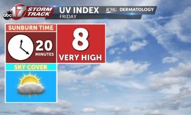
Tracking spotty pm storms with rising temps into weekend
TODAY: Isolated showers and storms remain possible with moderate downpours and lighting as the main threats. Highs warm into the mid-80s. TONIGHT: Overnight scattered showers and storms remain possible as lows cool to the upper 60s. EXTENDED: Hit-or-miss storms remain possible into the early weekend but most of us stay rain-free while temperatures gradually warm.
Continue Reading
Tracking climbing temperatures and spotty storms
THIS MORNING: Isolated showers are possible in the morning but most are clear and mild starting off in the upper 60s. TODAY: Skies remain mostly sunny with an isolated shower or storm possible. Highs reach the upper 80s. EXTENDED: Hit-or-miss storms remain possible into the early weekend but most of us stay rain-free while temperatures
Continue Reading
Black Vulture population and livestock attacks increasing
Landowners are starting to notice that black vultures are killing some of their newborn calves or some of their smaller livestock animals. The identical species to that of the turkey vulture is becoming a more prevalent issue across the region throughout the last several years. Black vultures are different than turkey vultures in that
Continue Reading
Tracking scattered storms tonight, big weekend warm up coming
TONIGHT: Partly cloudy with isolated to scattered showers and storms. Lows in the mid-upper 60s. TOMORROW: Isolated shower or storm with mostly sunny skies. Highs in the upper 80s. EXTENDED: A Severe Thunderstorm Watch is in effect until 10:00 for counties along and north of Highway 24 for the potential of 60 mph winds and
Continue Reading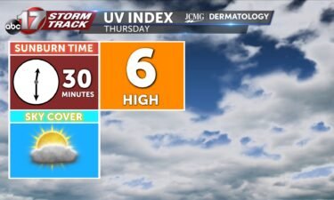

Insider Blog: Cooper County to have more radar access through partnership
A low power radar was installed in Boonville today, allowing the city and Cooper County access to weather information in the lower levels of the atmosphere in the surrounding area. The radar is owned and operated by Climavision, a company based out of Louisville, Kentucky focused on filling radar gaps between the high powered national
Continue Reading
Tracking overnight storms with a warmer weekend
TODAY: Wednesday is drier, but we retain a chance for a weak shower or storm on a very isolated basis. This evening, a short wave aloft will roll in on the heels of Beryl, driving these limited chances for rain. No meaningful rain comes from this, so the flood threat stays away. With more sunshine,
Continue Reading
Tracking drier and warmer weather through the weekend
TODAY: Wednesday is drier, but we retain a chance for a weak shower or storm on a very isolated basis. This evening, a short wave aloft will roll in on the heels of Beryl, driving these limited chances for rain. No meaningful rain comes from this, so the flood threat stays away. With more sunshine,
Continue Reading
Tracking the end of rain, warmer temperatures later this week
TONIGHT: Mostly sunny with an isolated shower or storm. Highs in the mid-upper 80s. TOMORROW: Mostly sunny with highs in the upper 80s. EXTENDED: Rain looks to completely move east out of the area by this evening, leaving us dry overnight with gradually decreasing clouds. We have picked up about 3/4″ in Columbia so far
Continue Reading
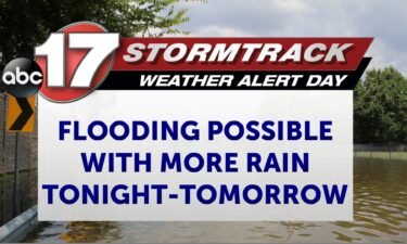
Weather Alert Day: Another round of rain could bring more flooding to Mid-Missouri
UPDATES: Tuesday Morning: There is little change to the forecast this morning, just an update in rainfall expectations. BLOG: The ABC 17 Stormtrack Weather Team has issued a Weather Alert Day ahead of the potential for more dangerous flooding as rain and storms return to Mid-Missouri tonight through Tuesday afternoon. The remnants of Tropical Storm
Continue Reading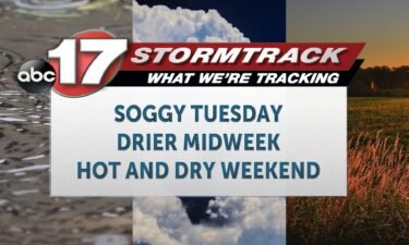
Tracking a soggy Tuesday with a light at the end of the tunnel
TODAY: Tuesday is an ABC17 Stormtrack Weather Alert Day as widespread rain from the remnants of what was Hurricane Beryl move through the region. Widespread 2-4 inches of rain in southeast mid-Missouri will be an issue as it falls over already saturated, or near saturated grounds, causing a flood threat. The majority of the region
Continue Reading